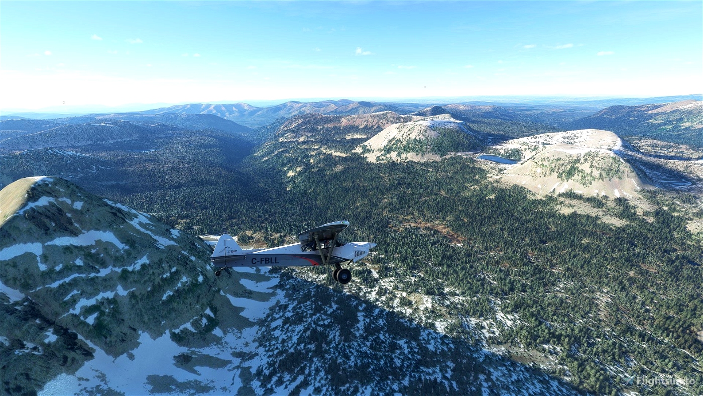
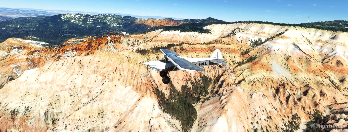
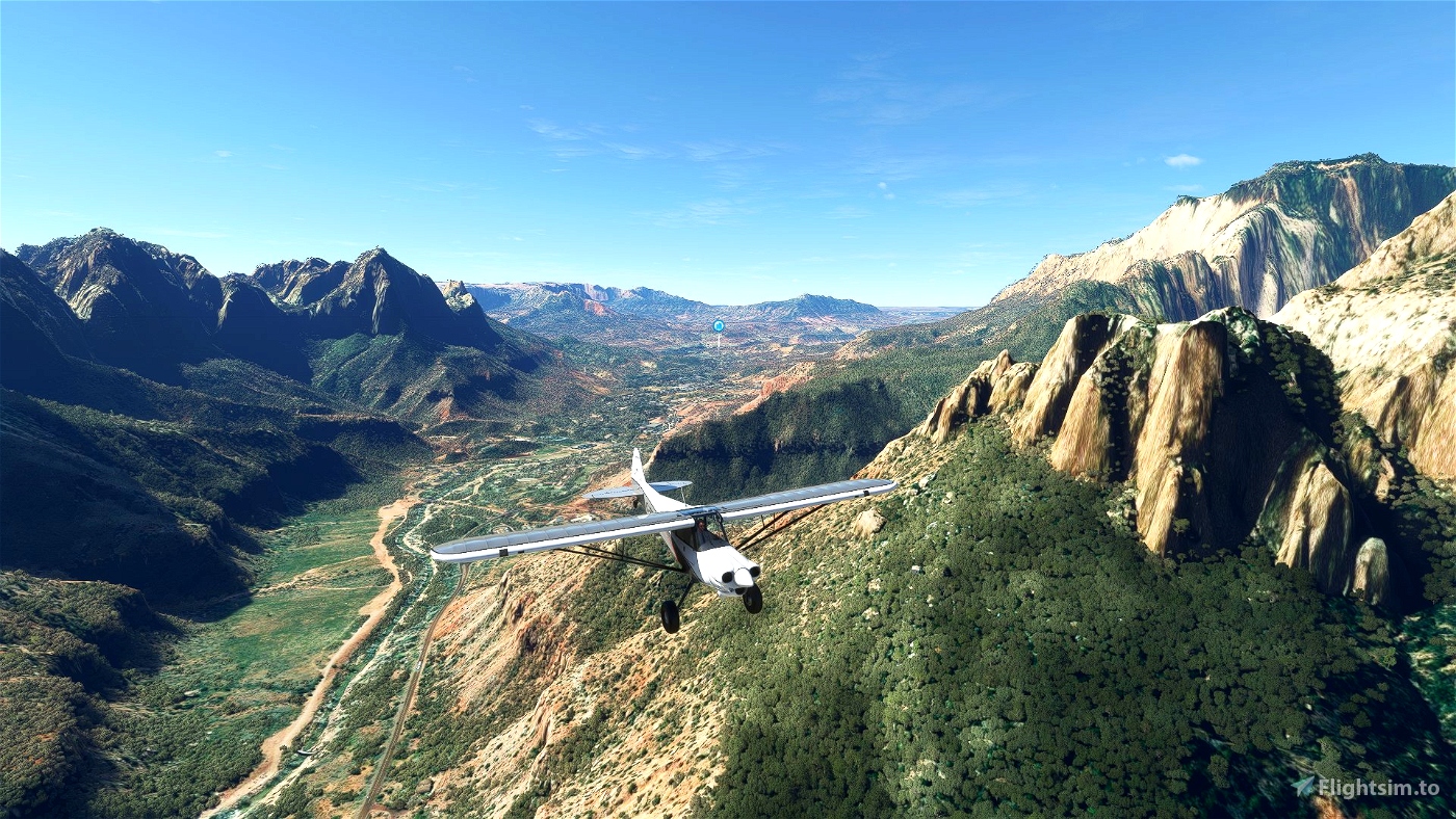

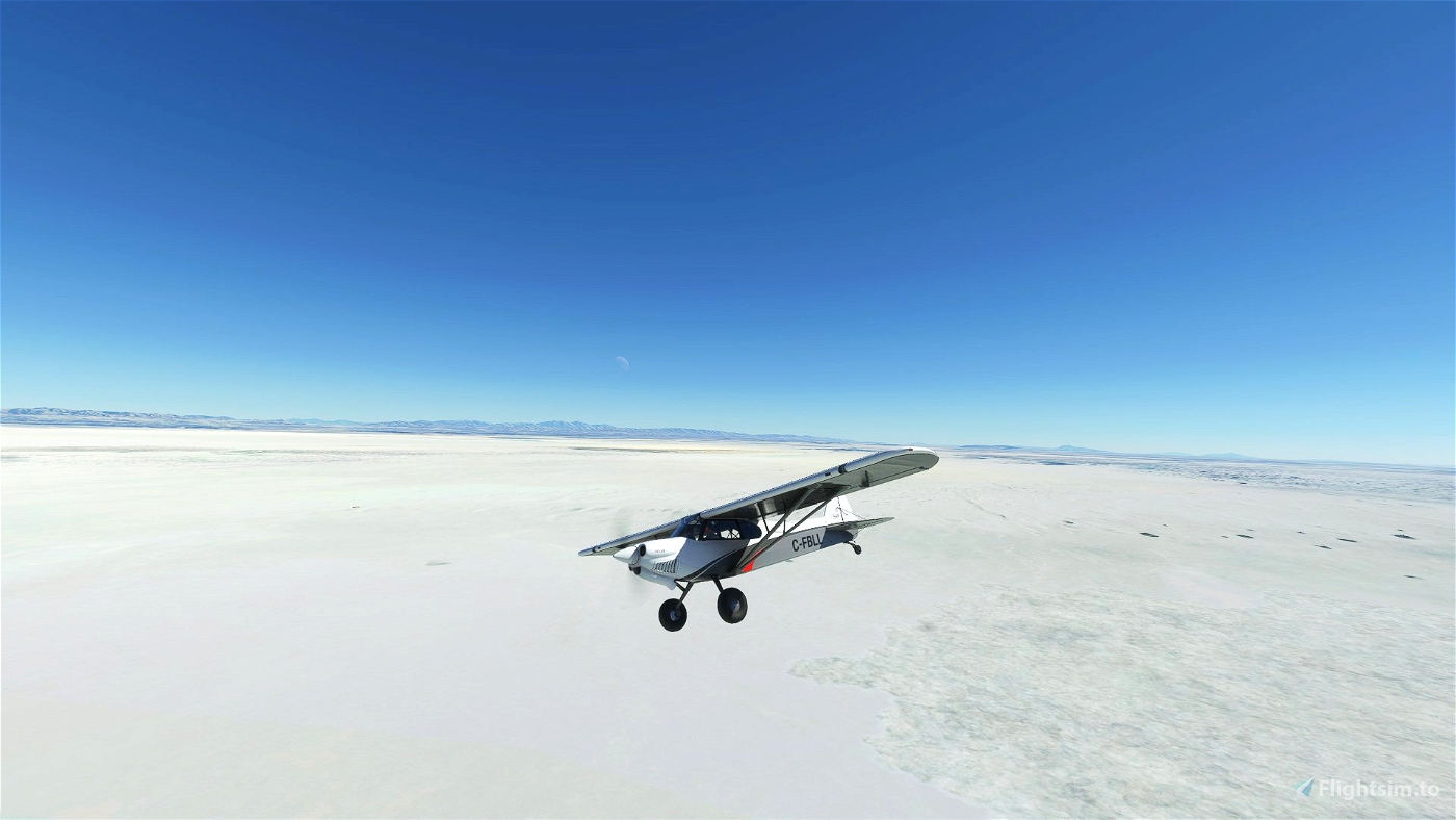

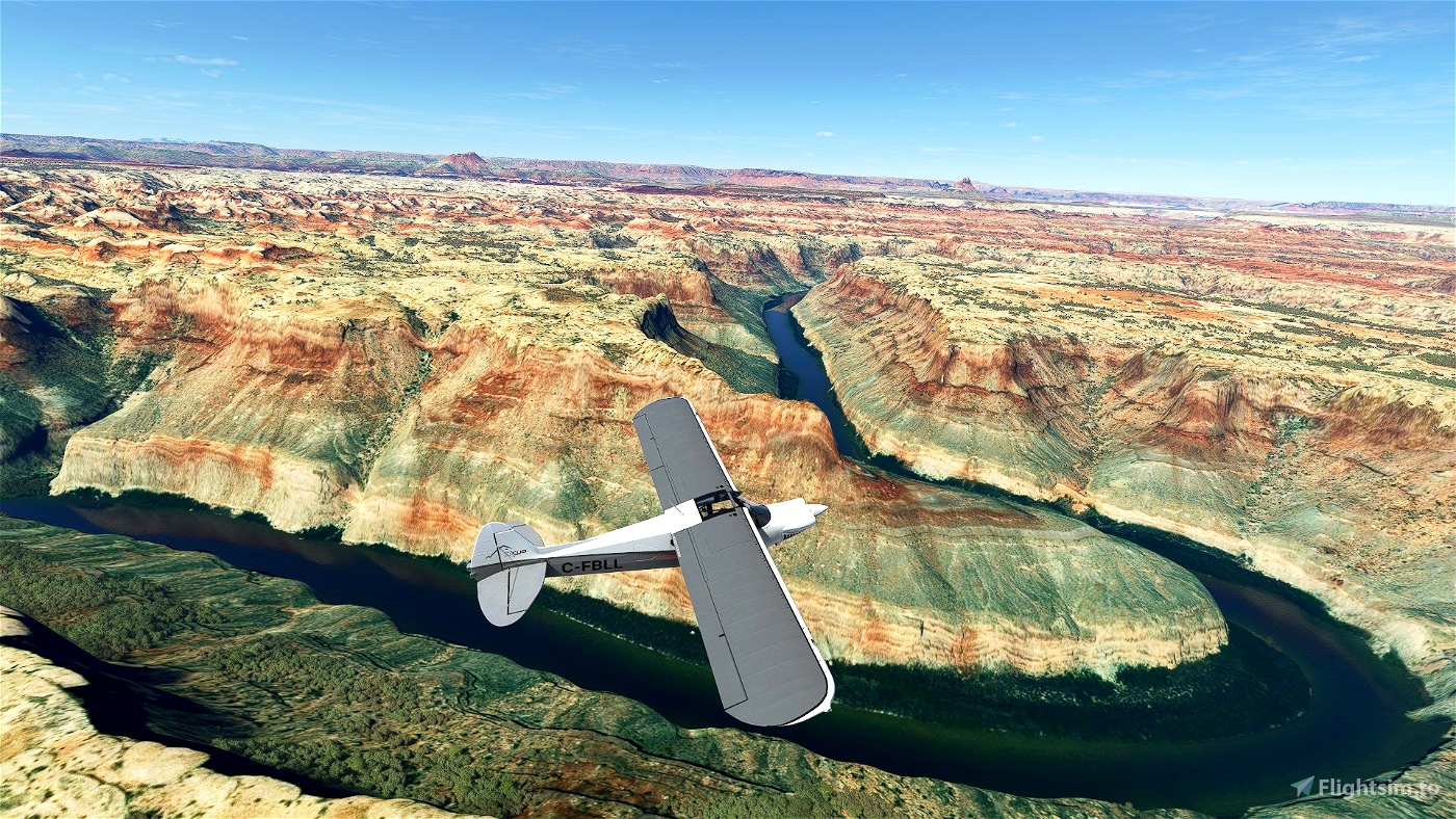
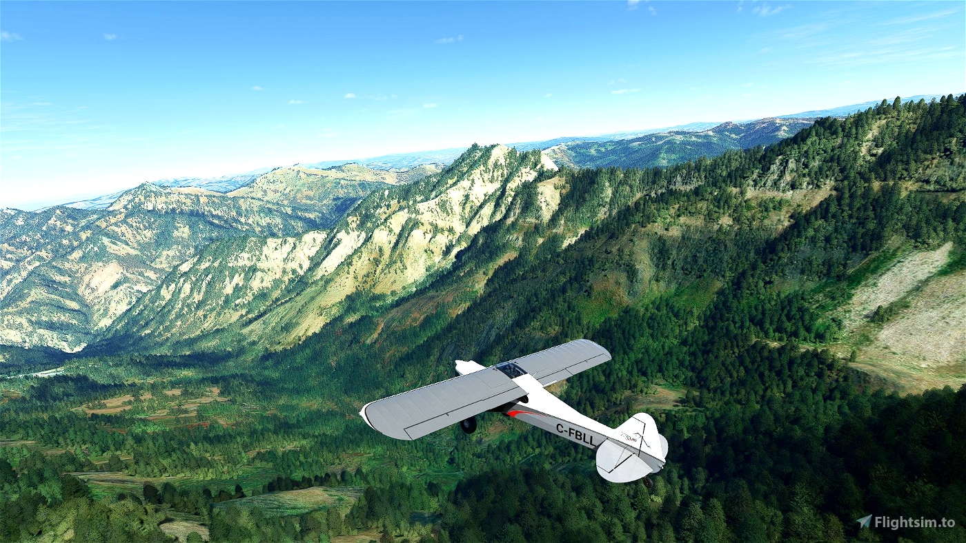

Utah Trails is a series of eleven consecutive flight plans over the great state of Utah, the heart of the intermountain west. With more national parks than any other state (excepting only California and Alaska) it boasts exceptionally varied and concentrated beauty. Beginning at the northern tip of Utah these flight plans cover the entire state from north to south over barren deserts and forested mountains, through deep red rock canyons and across green meadows.
Through these flights you will experience all five of Utah's national parks, including
- Zion National Park
- Bryce Canyon National Park
- Arches National Park
- Canyonlands National Park
- Capitol Reef National Park
You will fly through national forests and monuments, wilderness areas and state parks like the following, stopping at back country airstrips along the way.
- Wasatch National Forest
- High Uintahs Wilderness area
- Cedar Breaks National Monument
- Bonneville Salt Flats
- The Great Salt Lake
- Dead Horse Point State Park
- Skinwalker Ranch
- Monument Valley
- Goblin Valley State Park
- Lake Powell
- and many, many more.
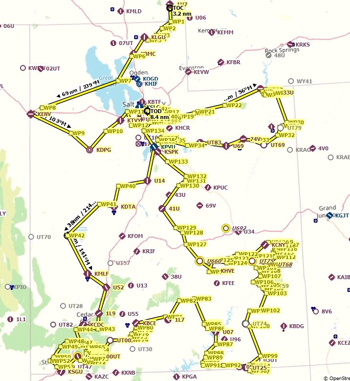
These flight plans were created for Microsoft Flight Simulator. The originals were created using Little NavMap and are included in the zip file.
10/2/21 update includes a "Utah Trails Waypoint Key" txt file.

We need more.
3 years ago
I'm not sure what you mean. More?
3 years ago
SamuraiSax
Marcinek2020
Nice. Thanks for showcasing the beautiful state that I live in.
3 years ago
Howdy, neighbor! I'm glad you like it.
3 years ago
SamuraiSax
fscam88