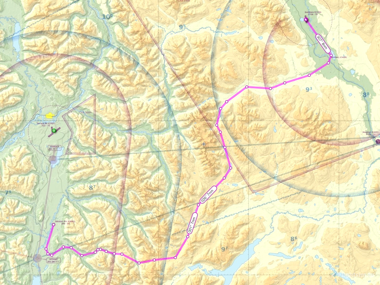
This is a short VFR GPS route flight/tour from Kitimat Airpark CBW2 to Smithers CYYD that takes you through the Kitimat back country to see the wonderful sights.
Simply place the .pln file into your "localstate" folder (a few back from community) and you can load the flight from the bottom of the main map window in the sim.
Recommended aircraft: any light aircraft that can operate out of a 3000 foot strip. The aircraft must be capable of a climb gradiant that can get it to 7500 feet altitude within 12nm from departure.
Trip distance 99 nm
Trip highlights: you will depart Kitimat Airpark and head south over the Kitimat River toward the Douglas Channel, Minette Bay, and the city of Kitimat. Fire Mountain will be on your left. You'll turn left past Fire Mountain to head up the Hirsch Creek Valley. Say goodbye to the town of Kitimat on your right. You'll see the amazing bowl of Kitimat's Mt. Elizabeth (6300') on your left. You must attain at least 7500 feet by the time you reach the end of North Hirsch. You will cross over the Kitimat River as it runs north from Mt. Atna which you'll see on your right. Mt. Atna is one of the highest peaks you see when you depart a commercial flight going south over Kitimat.
After crossing the Upper Kitimat River, you'll spot the turquoise water of little Atna Lake. It is fed from the glacial water of the Atna River spawned from the base of Mt. Atna as is the Kitimat River. Further in the distance you should see the larger Morice Lake.
Soon, you'll turn north to head up the canyons of the mighty Clore River. You'll meet the Burnie River and follow it to the Burnie Lakes. Spectacular views of the glaciers of Howson Peak will astound you. This is wild country.
After crossing over Burnie Lakes, we'll meet back up with the Telkwa Pass and join it to fly over the Telkwa River and up towards Smithers. Off to your left you should be able to spot the backside of Hudson Bay Mountain (the ski resort), and maybe even Aldrich and Dennis Lakes tucked in behind Hudson Bay Mountain.
You can start to descend as you head toward Tyhee Lake just east of Smithers. After overflying the lake, you can switch off your autopilot and head toward the city of Smithers and land at CYYD.
I hope you enjoy this backwoods tour of my area.
Scenery for Kitimat and Smithers is available on my webpage: genaiss.com/other-interests
Cheers!

 deltasim59er

