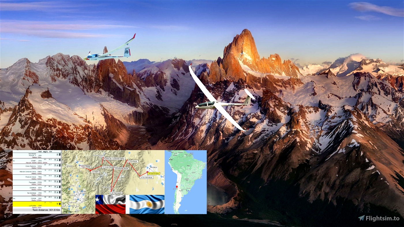
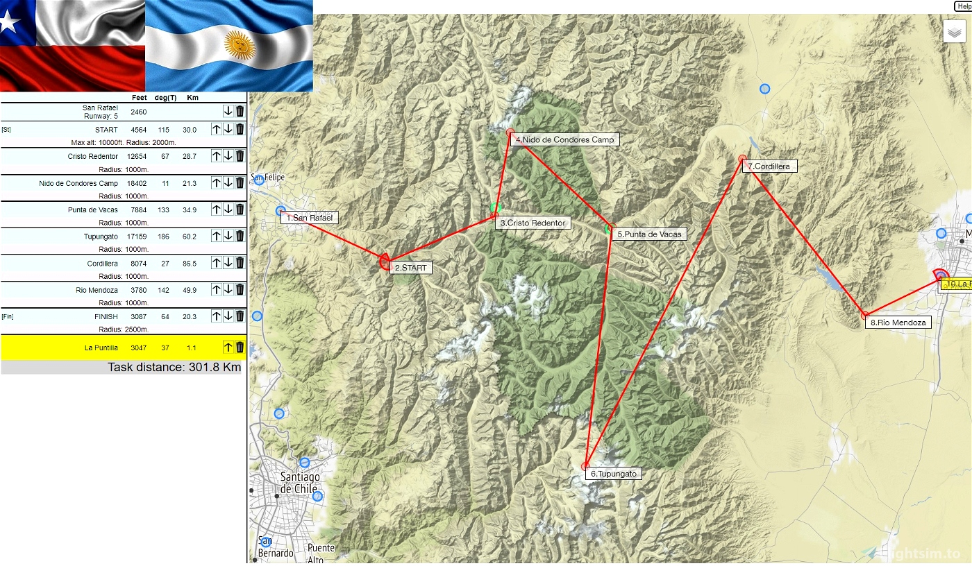
Distance:301km.
Length:1.5-2h. ..
Difficulty:Medium. ..
Departure: San Rafael - SCAN
Destination: La Puntilla - DOP
notes:
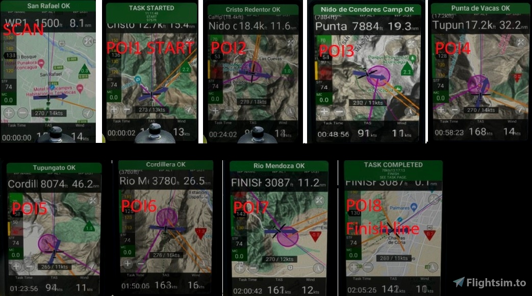
Pass POI1 "Start" point at 10 000 Feet MAX for best challangeWe are crossing the Andes mountain range flying from Chile to Argentina, crossing some famous landmarks such as the The Christ of the Andes pass and the Aconcagua mountain, which is the highest peak in the Americas.
Go through all the checkpoints and land at La Puntilla - DOP airfield.
Turn off your main battery when you have landed
Georg Ortner is the autor of the flight plan and weather
https://discord.com/invite/8TaW8QjH
https://www.youtube.com/GeorgOrtner
https://www.twitch.tv/videos/1534299342
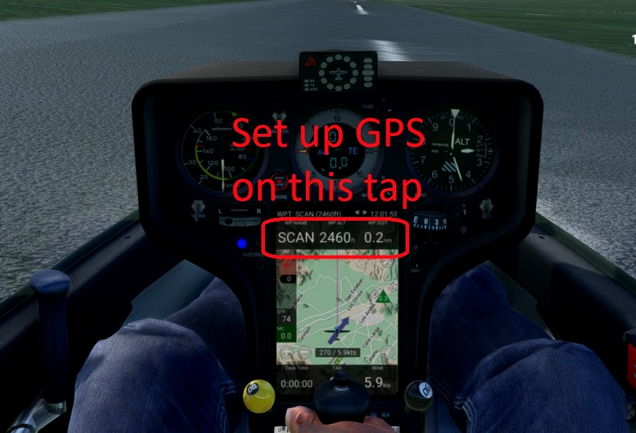
when you are on the runway.
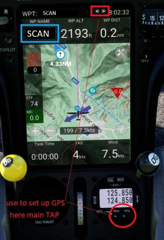
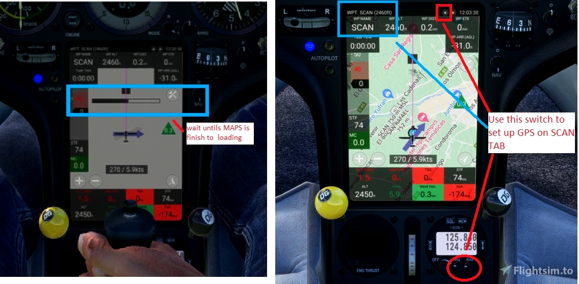
1-You must also set the GPS on the tap where there is the SCAN
View screenshots
Recommended Mods:
DG808s
https://fr.flightsim.to/file/30384/dg-flugzeugbau-dg-808s
lxn-dg808s
Replacement mod for the Touching Cloud DG808s Nav computer
https://github.com/JackBilbo/lxn-dg808s
or
DG808S - LXN Nav Replacement » Microsoft Flight Simulator
Keybinds
Several functions can be operated by keybinds from joystick or throttle:
Page left/right: INCREASE/DECREASE COM1 (WHOLE) Page up/down: INCREASE/DECREASE COM1 (FRACT)
Waypoint next/prev: INCREASE/DECREASE TRANSPONDER (1000) Map Zoom: INCREASE/DECREASE TRANSPONDER (10)
Map Orientation: INCREASE/DECREASE TRANSPONDER (1)

 ADCKillerman


Thank you!
1 years ago
Ginete