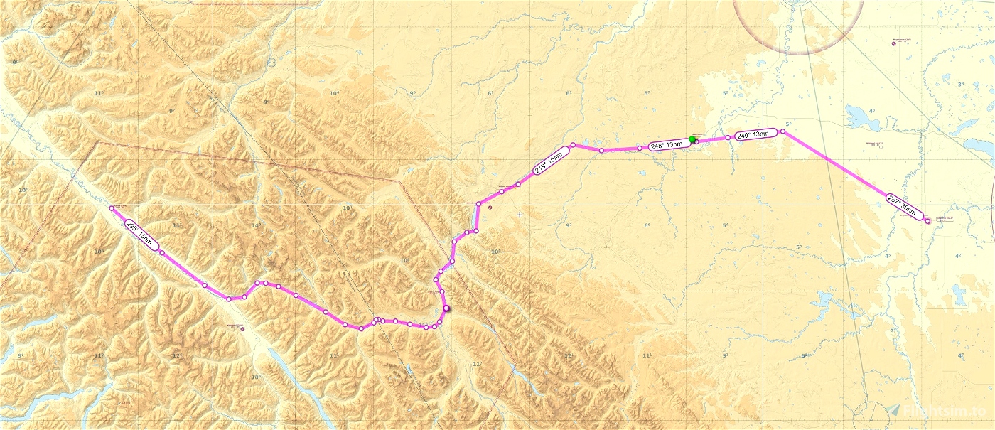
This is a flightplan route based on the published VFR route from McBride British Columbia(CAV4) to Drayton Valley Alberta (CER3).
You can place the .pln file into your localstate folder then load it from the bottom of the main map window in the sim. Follow along on your MFD or
use autopilot nav mode to lock onto the route.
Trip distance 233 nm
Suggested altitude 7500'
Reverse plan is included...
Enjoy!
Sceneries available on my page. (see readme)

 deltasim59er


Nice flight (MSFS crashed near to landing when i started playing around with G1000 😞 )
3 years ago
It's a nice area. I guess you'll have to fly it again lol
3 years ago
deltasim59er
simuk123
Beautiful area ! This one is gonna be fun and the scenery familiar . Thank you.
3 years ago
Thanks for downloading. Enjoy!
3 years ago
deltasim59er
Tester4301
This looks like fun. Where do I find my localstate folder.
3 years ago
If you go to your community folder then just backtrack a few it's there :)
3 years ago
deltasim59er
Cessna777